Strategic Intermodal System (SIS)
|
The Strategic Intermodal System (SIS) is Florida's high priority network of transportation facilities that are important to the state's economy and mobility and the most significant for interregional, interstate, and international travel. The SIS is the state's highest priority for transportation capacity investments given limited transportation resources.
|
Why is the SIS important?
SIS facilities are the workhorses of Florida's transportation system and account for a dominant share of the people and freight movement to, from, and within Florida. SIS highways accommodate 54% of total vehicle miles traveled (VMT), even though they represent only 35% of state highway centerline miles. The SIS also serves 89% of customers using passenger rail. Additionally, the SIS is responsible for at least 99% of Florida's:
|
Guiding Plans
Florida Transportation Plan and SIS Policy Plan at www.floridatransportationplan.com
FTP Vision Element
|
FTP Policy Element
|
SIS Policy Plan
|
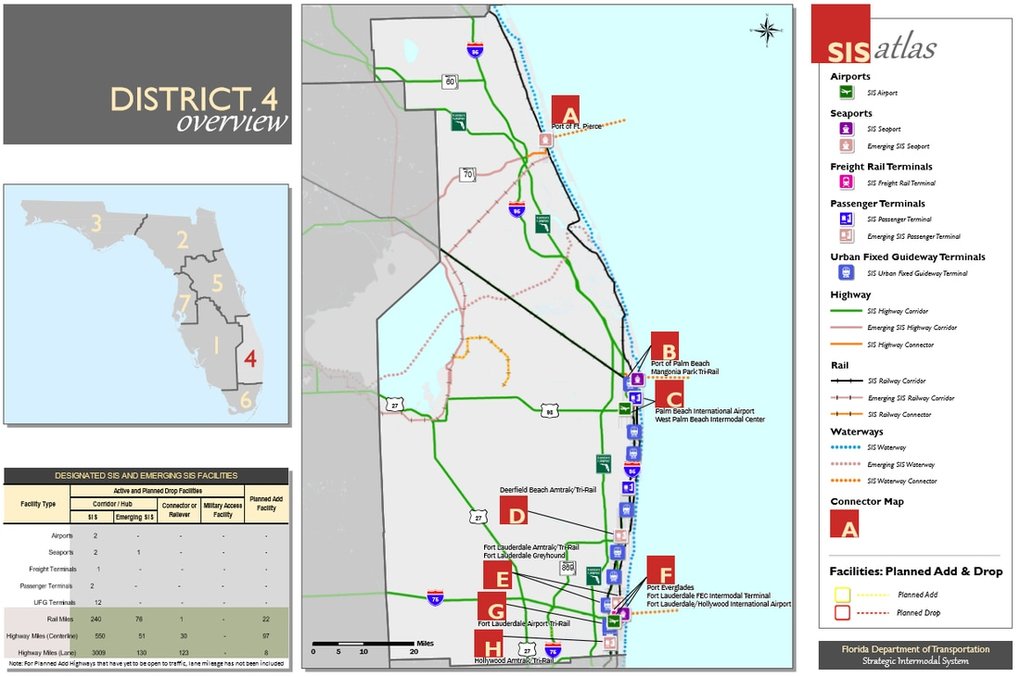
Designated SIS Facilities
FDOT maintains a SIS Atlas that identifies the location of three types of designated SIS facilities:
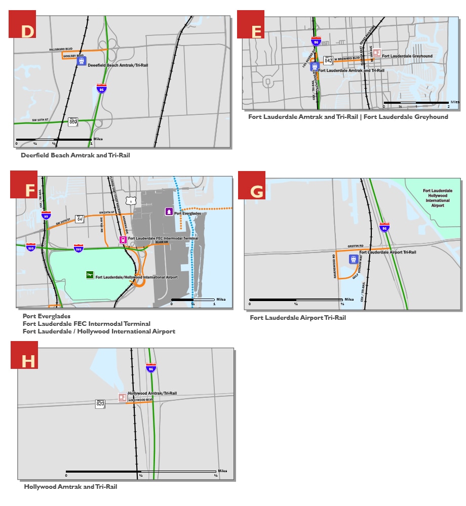
Maps for SIS designated facilities in FDOT District Four are below. The letters on the maps represent SIS highway connectors.
Designated SIS facilities within or crossing the area covered by the I-95 Corridor Mobility Planning Project are:
- Transportation hubs (ports and terminals) moving people or goods;
- Interregional corridors (highways, rail lines, waterways and urban fixed guideway transit facilities) connecting major origin/destination markets; and
- Intermodal connectors (highways, rail lines, or waterways and other exclusive use facilities) linking hub-to-corridor; hub-to-hub; or strategic military installation-to-corridor
Maps for SIS designated facilities in FDOT District Four are below. The letters on the maps represent SIS highway connectors.
Designated SIS facilities within or crossing the area covered by the I-95 Corridor Mobility Planning Project are:
- SIS hubs: Fort Lauderdale-Hollywood International Airport; Port Everglades; and multiple passenger, urban fixed guideway, and freight terminals
- SIS corridors: I-95, Florida’s Turnpike, I-595, Sawgrass Expressway, SW 10th Street, Florida East Coast Railway, South Florida Rail Corridor, Atlantic Intracoastal Waterway
- Multiple SIS highway connectors from hubs to I-95
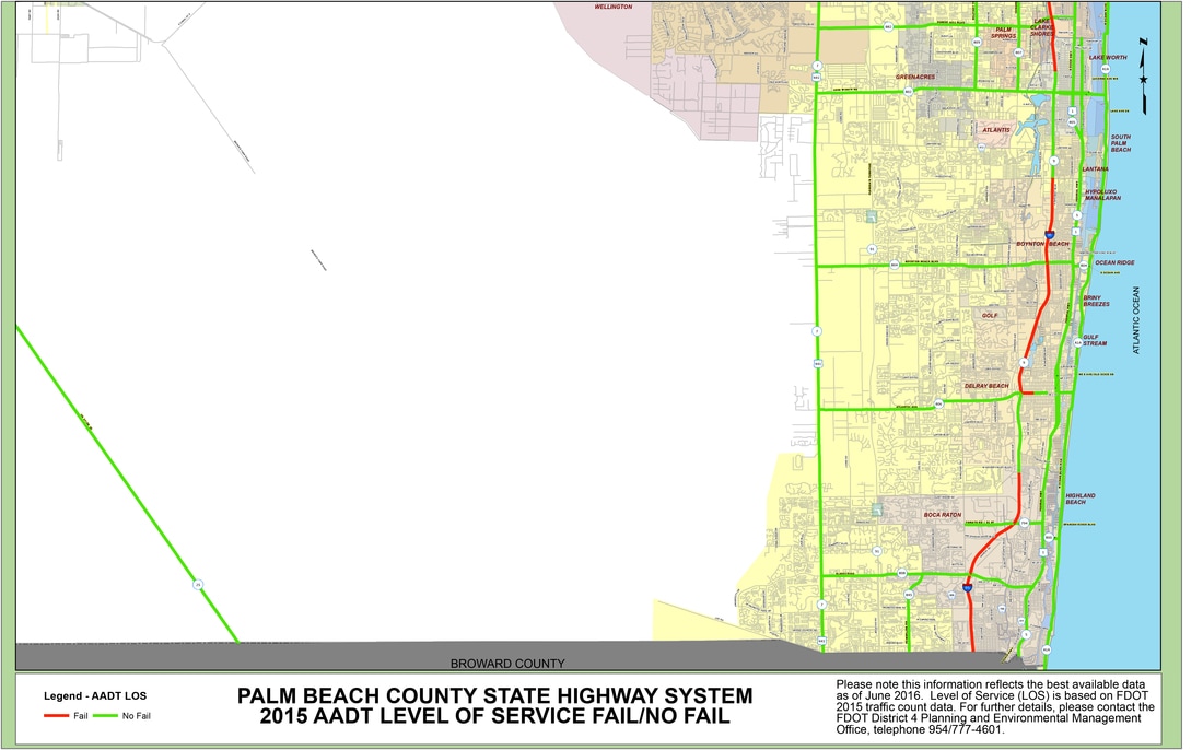
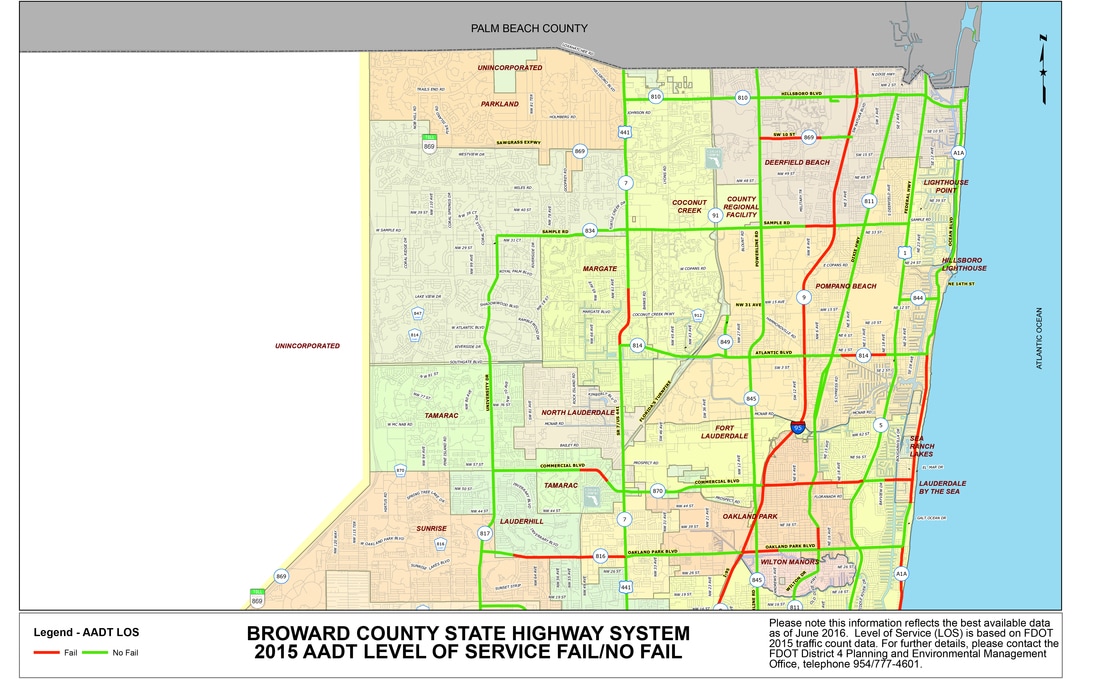
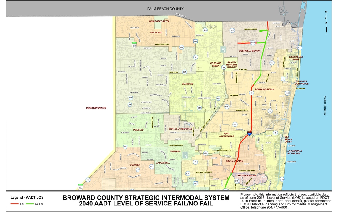
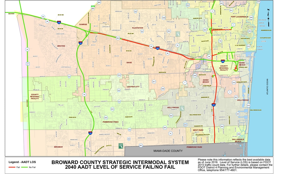
AADT Level of Service (2015 and 2040)
Map series 1:
|
Map series 2:
|


Additional Links
|
State Highway System AADT - Fail/No Fail (2015)
State Highway System AADT - Level of Service (2015) State Highway System Peak Hour Directional - Level of Service (2015) |
Strategic Intermodal System AADT - Fail/No Fail (2040)
Strategic Intermodal System AADT - Level of Service (2040) |
SIS Related Documents & Links
|
|